Project
The planting design on the site you studied.
Move from the site study to a concrete vineyard: boundaries, rows, vines and varieties, with numbers and documents to check and use in your work.
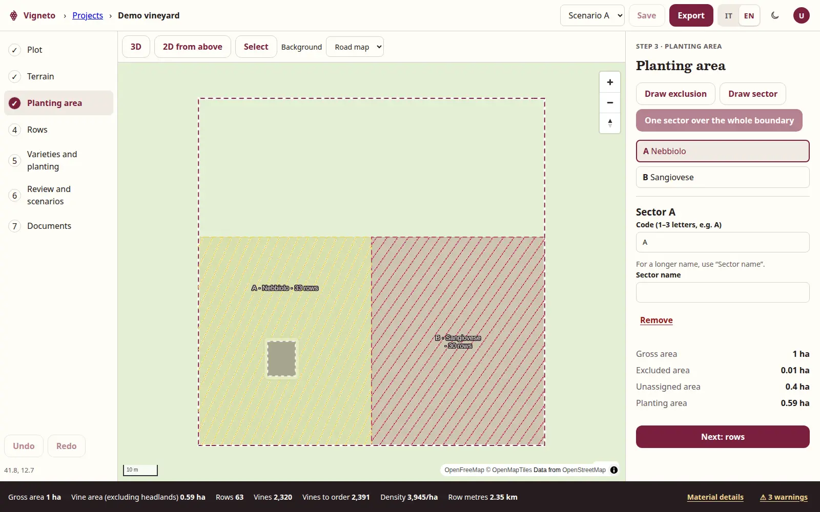
From land to planting
Seven steps. A measurable project.
Every image shows a real stage of the same demonstration project or a document exported from it.
Plot
Draw the boundary on the map or upload a boundary file. The starting point and study remain linked to the project.
You can exclude buildings, ditches, trees and other unplanted areas, leave headlands and divide the land into sectors.
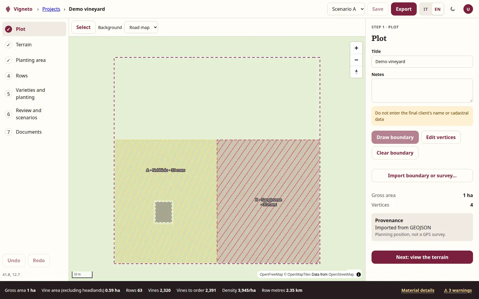
The boundary and sectors of the demonstration project. Rows and vines
For each sector, choose orientation, row spacing and vine spacing. Set headlands, boundary margin and minimum row length.
Vigneto draws numbered rows and vines and updates quantities. You can also compare automatic proposals based on geometric objectives.
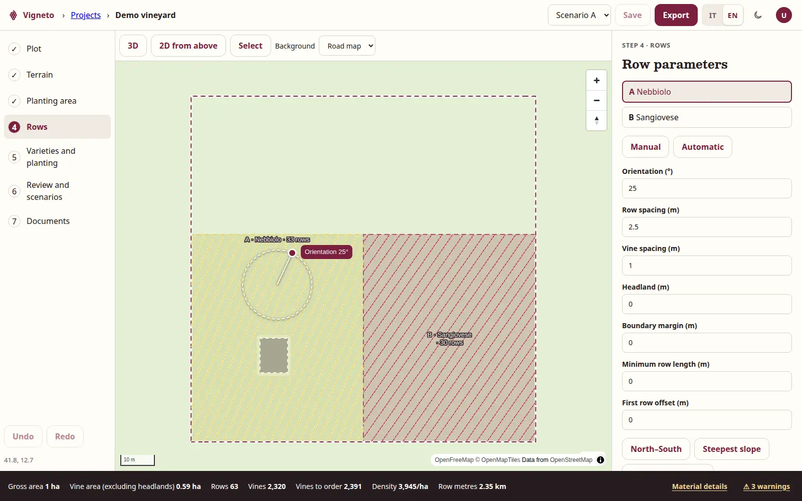
The parameters and calculated layout of rows and vines. Varieties by sector
Assign a grape variety and training system to each sector. You can record rootstock and clone, together with materials and vines to order.
Vigneto suggests suitable grapes based on the study, but the choice remains with the technician.
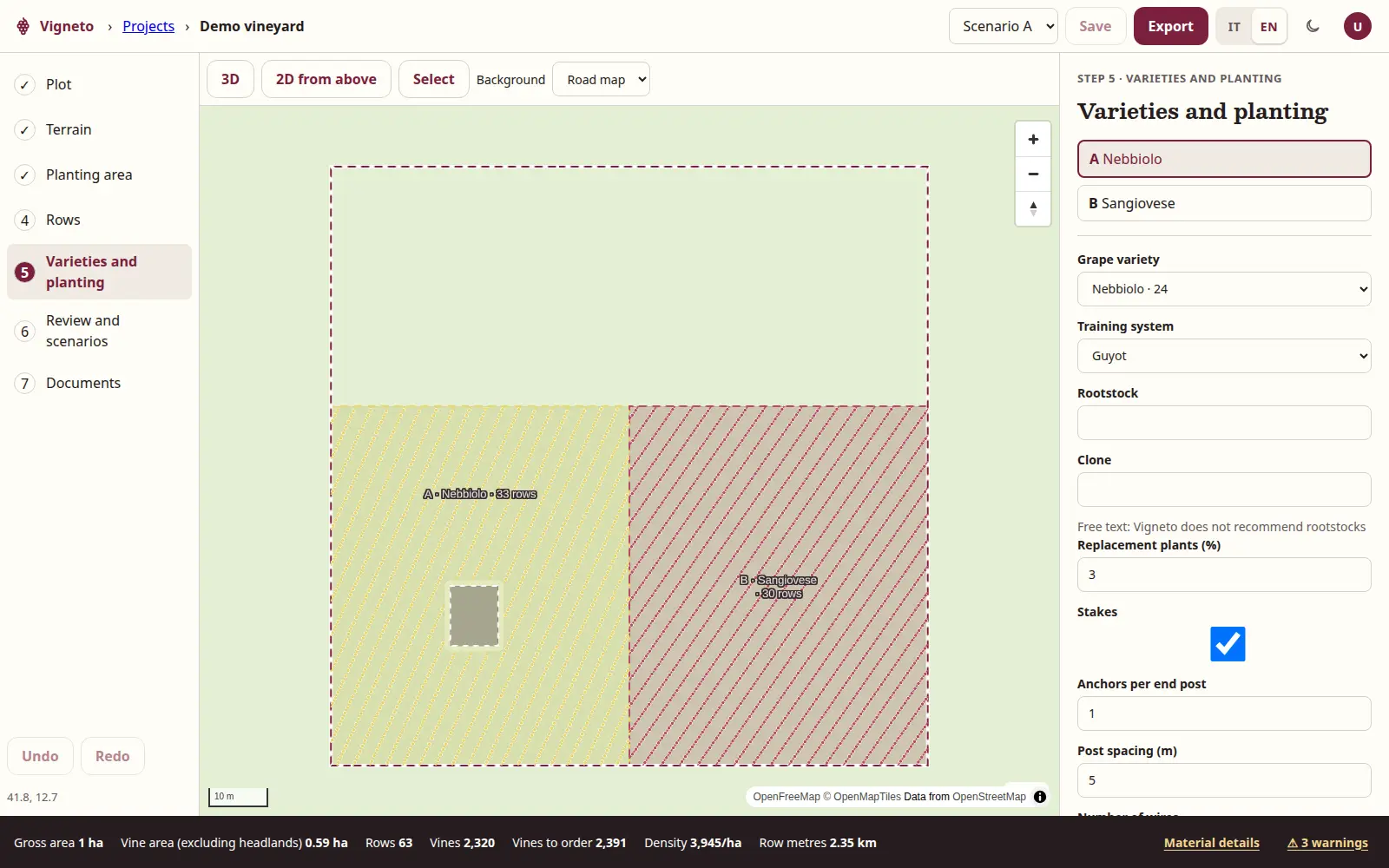
Variety and planting choices for each sector. Scenarios to compare
Compare two or three alternatives, such as rows in different directions or different planting distances.
Alternatives are shown side by side with the same measurements: areas, rows, vines, density, row metres and materials. No economic or productive comparison.
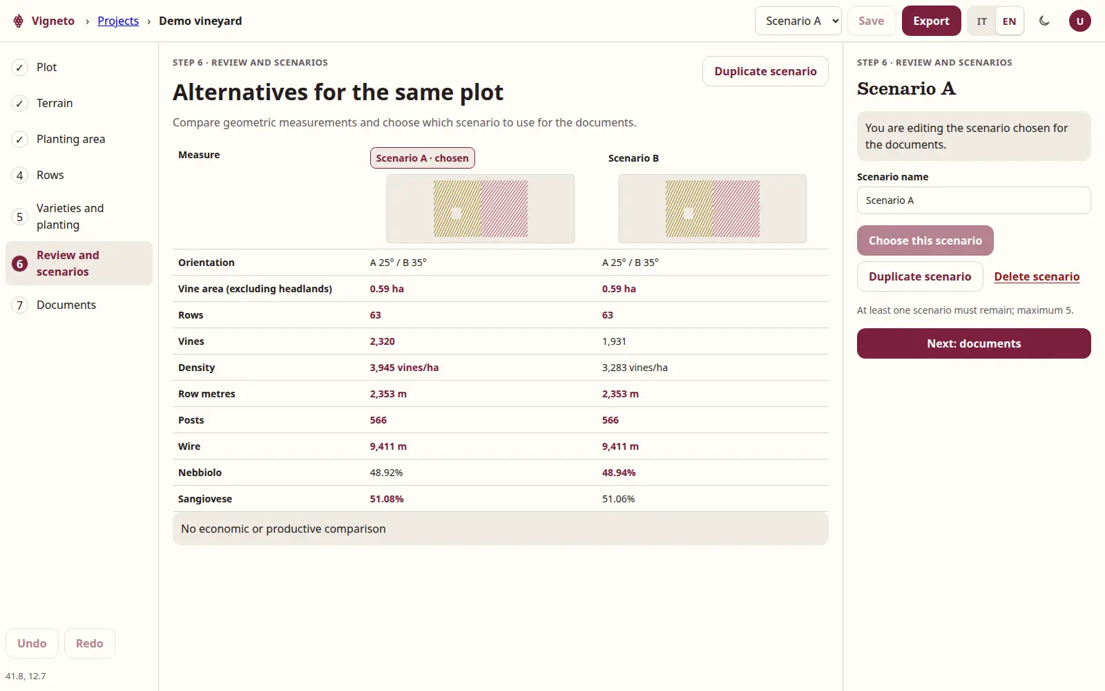
Two scenarios for the same plot, with the same measurements. Plan
Export a scaled drawing with boundaries, exclusions, sectors, headlands, and numbered rows and vines.
The A3 PDF plan includes north arrow, scale bar, grid, legend and title block with the document code.
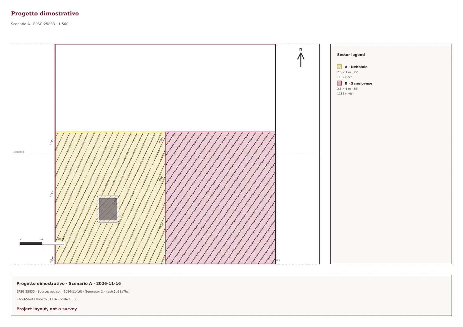
The plan exported from the demonstration project. Quantities and materials
Get gross and net area, rows, vines, vines per hectare and row metres, by sector and in total.
The project also calculates vines to order, end and intermediate posts, anchors, stakes and metres of wire.
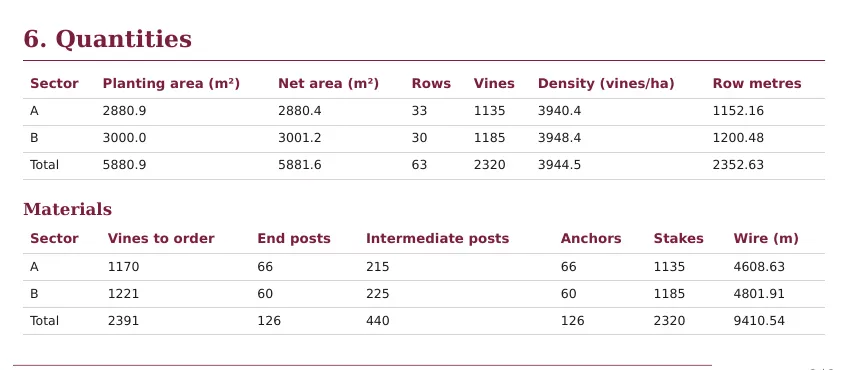
Quantities and materials in the exported report. Exports
Download the report in PDF and Word, the PDF plan and files for the other tools in your work.
DXF for CAD; GeoJSON and KML for geographic software; CSV for vine positions and quantity tables.
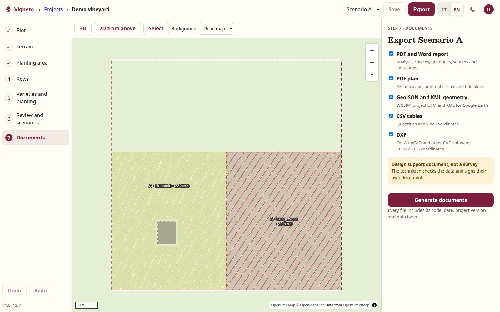
All documents available for the chosen scenario.
From Report to Project
The same point. No copying the data again.
Start from the analysis you have already studied: climate, soil, grapes and appellations come from the point and remain linked to the project.
In the Project you can correct data with your measurements, extend the terrain reading inside the boundary and use the results in your planting choices.
Responsibility
Who signs
The technician. Vigneto prepares the study and design as support: it does not sign and is not professional advice. The technician checks the results and signs their own document with their own tools.
Plans
One planting design, or all your projects.
Single project
One project and its report, with plan, quantities, materials and all exports.
Unlimited projects
Annual subscription with unlimited projects and reports included.
During the pilot they are free, by invitation. Prices will come after the pilot.
Project questions
Before you
start drawing.
Where do I start?
From the map: choose a point, read the analysis and open “Design a vineyard here” in Next steps. The project reuses the site study.
Can I divide the plot into sectors?
Yes. You can draw different sectors, exclude unplanted areas and assign rows, variety, training system and materials to each sector.
Can I compare alternatives?
Yes, two or three scenarios with different orientations or planting distances. The comparison uses the same geometric measurements and materials, without promising yields or economic results.
Is the plan a survey?
No. Row and vine positions are design positions, not GPS measurements taken in the field. The plan always carries the warning “Project layout, not a survey”.
Which files can I export?
PDF and Word report, PDF plan, DXF, GeoJSON, KML and CSV. Every document is linked to the scenario and saved project.
Who signs the design?
The technician. Vigneto prepares the study and design as support: it does not sign and is not professional advice. The technician checks the results and signs their own document with their own tools.
The pilot
Bring a real project to the pilot.
The pilot is free, by invitation: 10 reports and Projects for 10 weeks, in return for your expert perspective.